필요한 최적의 소프트웨어와 컨설팅을
공급하도록 노력하겠습니다.


| . |
|
| 응용사례 |
|
|
|
|
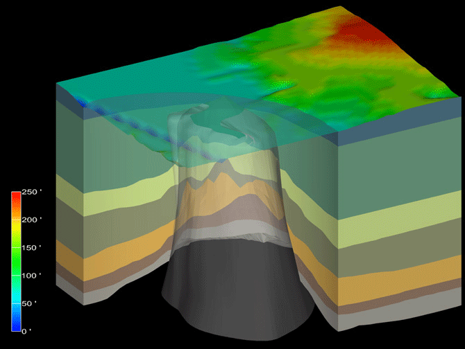
| The Bayou Choctaw salt dome in southern Louisiana is used as one of the U.S. Department of Energy's principal underground storage facilities for crude oil as part of the Nation's Strategic Petroleum Reserve. The intrusive salt core has risen many tens of thousands of feet, penetrating various sand-shale sedimentary layers to reach its current spatial position. Crude oil is stored in large (300 ft diameter x 2000 ft high) caverns leached into the salt mass using solution mining. |
|
|
|
|
|
|
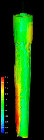
The salt cavern to the left is typical of solution mining structures created for the Strategic Petroleum Reserve. Dimensional data is used to assess total volume and structural integrity. The surface is colored according to out-of-round condition. |
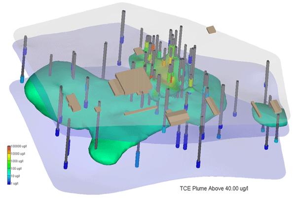
Soils adjacent to a former nuclear facility were contaminated by uranium emissions during operation. The emissions appear to have been concentrated adjacent to building walls by rain-runoff from the roofs of the facility buildings. These contaminated zones were explored using angled borings to measure beneath the building foundations. A three-dimensional geostatistical simulation of 100 equiprobable realizations of this deep uranium was imported into MVS to distinguish the contaminated and total volumes of soils associated with the building walls and footers. |
|
 |
|