
연구의 선진화와 생산성 향상에
필요한 최적의 소프트웨어와 컨설팅을
공급하도록 노력하겠습니다.
필요한 최적의 소프트웨어와 컨설팅을
공급하도록 노력하겠습니다.


RAMMS features
- Advanced 3D visualization interface for digital elevation models, aerial imagery, topographic maps, simulation results and additional georeferenced datasets.Topographic map and aerial imagery ⓒ 2010 swisstopo (JD100007)
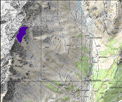 2D topographic map
 3D terrain
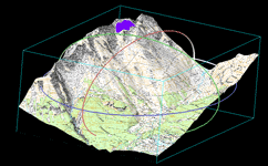 3D topographic map
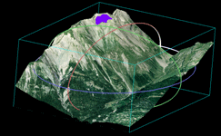 3D aerial imagery
 - GIS tools such as slope angle, curvature, contour and friction parameter calculation.
 Slope angle
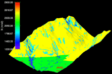 Friction parameter
 - Manual release area and forest editing tools.Aerial imagery ⓒ 2010 swisstopo (JD100007)
Slope angle
Friction parameter - Calculation and animation of runout distance, flow height, velocity and impact pressure.Aerial imagery ⓒ 2010 swisstopo (JD100007)
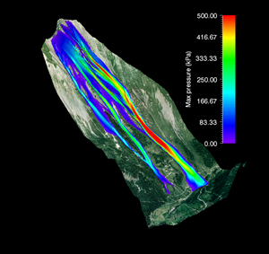 Maximum pressure
 Maximum velocity
 - Export the results to Google Earth, ArcGIS and other tools.
 Google-Earth visualization of the exported result.

