Discovery is a click away! The Geographic Explorer extends the Windows 95, 98, 2000 and NT Explorer to view and find map files. The Geographic Explorer provides a number of powerful utilities. You can explore map files directly on your desktop with the Geographic Explorer! Supports MIF, SHP, TAB, DWG, DXF, DGN, TIFF, BMP & JPG.
Geographic Explorer
Features
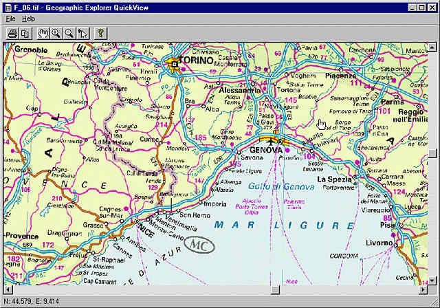
Explorer QuickView
Do you want to view raster and vector map files with the single click of a button? The Explorer QuickView function makes it a snap!
QuickView your map files!
Right click on map files from within the Windows Explorer to instantly view the contents of the files. The viewer allows you to zoom in, zoom out, and pan around the map.
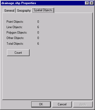
Adds Geography and Spatial Objects tabs to the Properties of the map files. Simply right click a map file from within the Windows Explorer and find out what it is and where it is!
Extend the Windows Explorer!
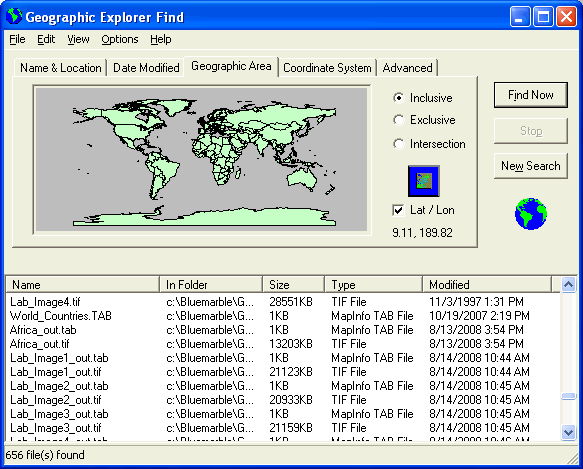
Explorer Find
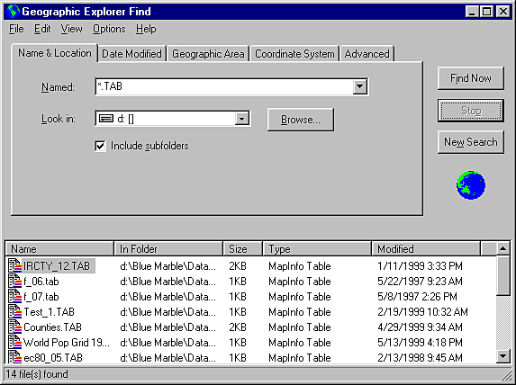
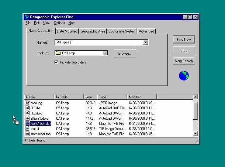
Do you want to find, view, print, and copy any map file to the clipboard based on it's geographic location? Check out the Explorer Find function! It adds a whole new level to "find files"--it can search by geography! That's right - geographically search your system and network.
Find map files by name!
Find map files by coordinate system!
DRAG and DROP from the finder to launch map files into your favorite application.
Drag and Drop - find and launch!
Geographic Explorer
Details
QuickView Vector Formats
ESRI SHP
AutoCAD R14 DWG and DXF
MapInfo TAB and MIF
Microstation DGN (2D only)
Blue Marble BML
QuickView Raster Formats
TIFF
Windows BMP
JPEG
Geographic Explorer
User Comments
"The Geographic Explorer is a breakthrough product for Blue Marble and our users. It solves a compelling need for every Windows user who is using any mapping/CAD system on the market in a very nifty way. It's simple in its elegance, easy to understand, and works seamlessly on a users desktop. It epitomizes the essence of what we are about as a company in today's marketplace."
Jeff Cole - President, Blue Marble Geographics
"Congratulations on a slick and well thought out product. Even my boss, a notorious non-spatial thinker, has enjoyed using the Explorer!"
Blaine
"All I can say is that I was totally delighted to download the Geographic Explorer. It did exactly what I needed and was better than spending hundreds more on another application. Thanks for your software, I'm glad I found it!"
Q: I need to know what type of objects are in my ESRI Shape files before I actually open them into ArcView. Can the Geographic Explorer tell me this? A: Yes. The Geographic Explorer adds Geography and Spatial Objects tabs to the Properties of the map files. Simply right click a map file from within the Windows Explorer, go to Properties, and select the Spatial Objects tab. You can query your file for type and and number of objects.
Q: I often need to find all available data for a specific region over my network. This is very time consuming. Can I search my network for all the map or image data by geographic location? A: Yes. The Geographic Explorer QuickFind (Start/Find/Geographic Explorer Find) can search your network for map and image files by user-defined geographic location. Select the "Geographic Area" tab, and specify the bounds of your search on the world map. All files that are located in the specified region will appear in a box at the bottom of the interface. You can also perform searches by Coordinate System, date modified, and file size.
Q: How do I "QuickView" the maps and images with the Geographic Explorer? A: QuickView is initiated from a right click on the map file from Windows Explorer, or even on your desktop. The Geographic Explorer adds a Geographic Explorer QuickView? menu option to the popup menu. Simply select this menu item, and the file is immediately launched into the Geographic Explorer View Map Window.
Q: Can I produce color prints of my map and images files with Geographic Explorer? A: Yes, if you have a color printer that is supported by Windows. You simply need to launch the file into Geographic Explorer QuickView, select the desired area in the View Map Window, then access Print from the file menu. This will send the selected region to your color printer.


 QuickView your map files!